03/13/2020
This Corona Virus, COVID-19, is all over the news. It seems that you can’t get food, sanitizer, or toilet paper, go out in public, and you should prepare to hunker down at home. Schools and workplaces are closed. But the National Parks are still open!
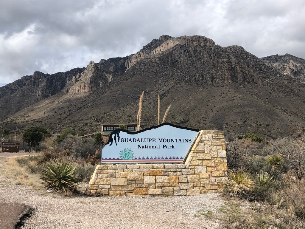
I had originally planned to go to Guadalupe Mountains National Park back in February, but a family emergency came up and I had to postpone it. I’m very glad I did, because on Saturday the park was doing a ranger guided hike up to Guadalupe Peak, the tallest peak in Texas, and I went to join along!
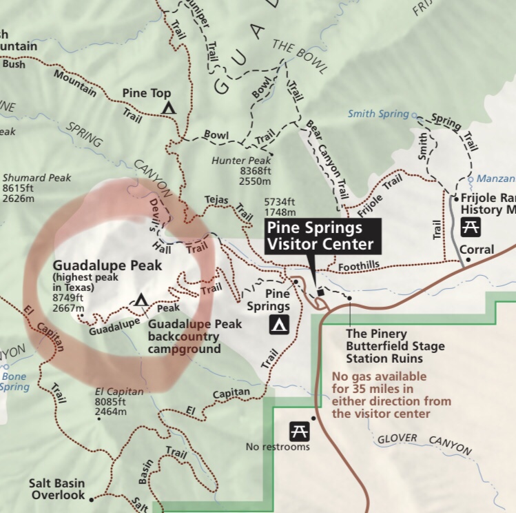
So as you can see from the park map, the peak is 8,749 ft., round trip 8.4 miles, and is labeled “strenuous.” So I had to be prepared!
I had my daypack for the actual summit, but I got to bring everything in my Osprey Ace 50 pack to try out, which is made for kids but great for my tiny self.
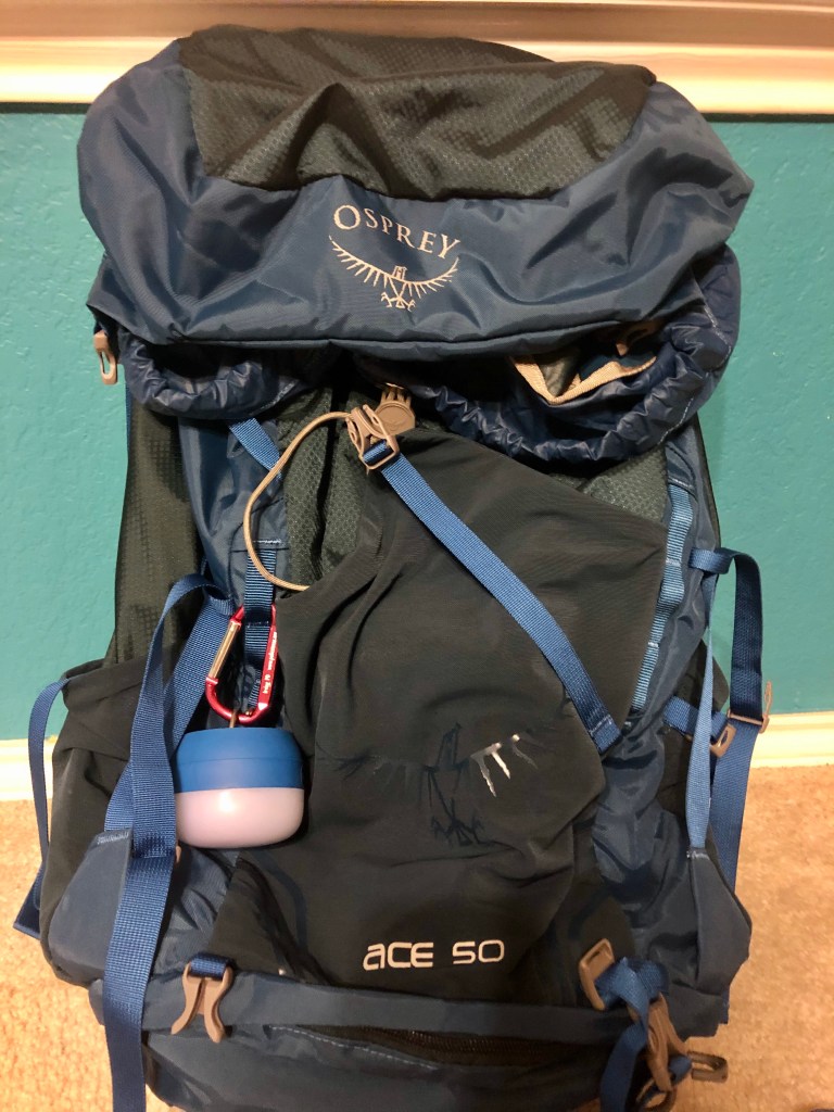
This was just in case I had to sleep somewhere else because the campsites were probably full due to it being spring break and they don’t do reservations beforehand.
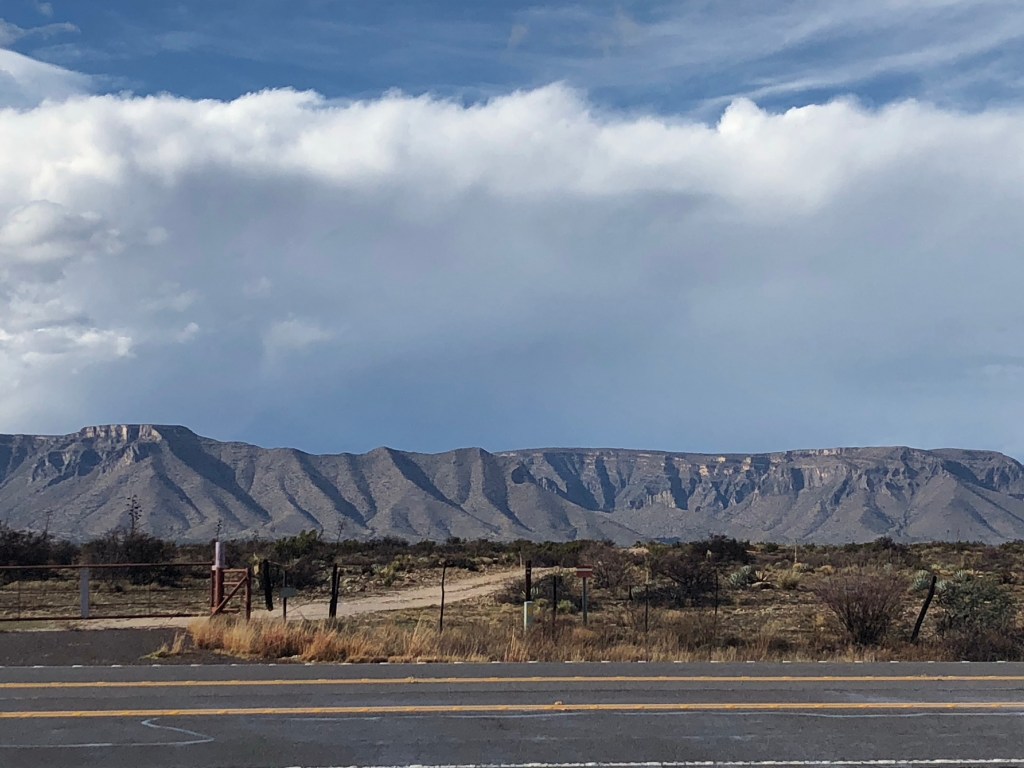
So begins the long drive that takes about 7 hours. Lots of flatness, then mountains. Cute sheep and menacing looking vultures that were eating something so enthusiastically that they hopped around the carcass.
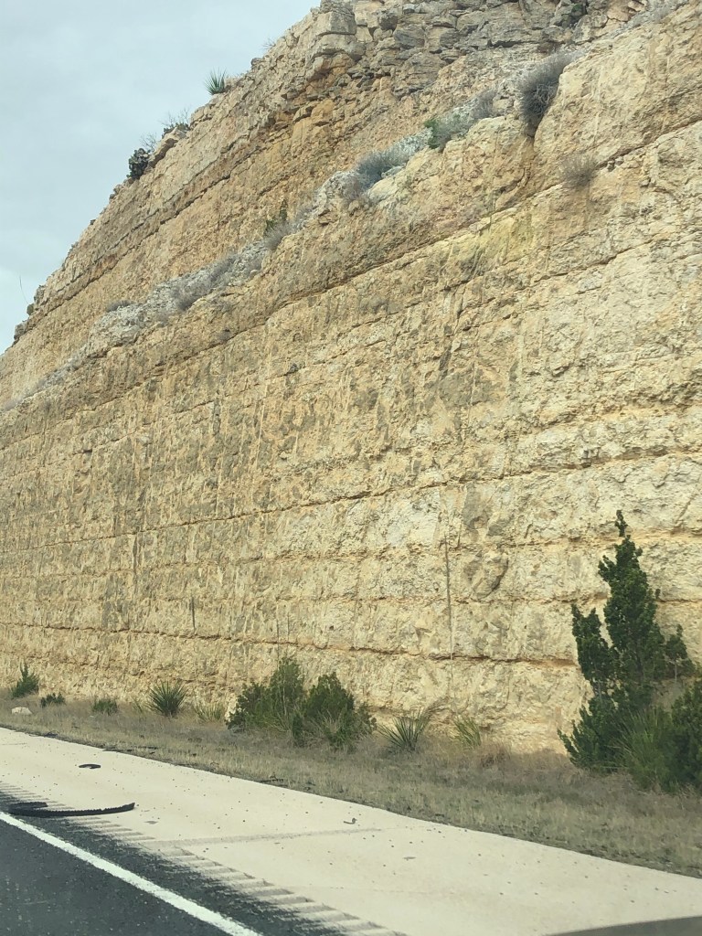
I took a slightly shorter route through Pecos, Texas, where there was some nice painted cowboy boots sculptures. The smaller highways off of the main IH-10 highway are terrible though, with lots of potholes. You also change to Mountain time as you get closer, but for some reason your cell phone flips back and forth between zones.
I arrive at the Visitor’s Center around 2:30. I get obligatory souvenirs in case I don’t make it tomorrow after the hike. Campsites unfortunately are all full, but you can go to a nearby BLM (Bureau of Land Management) campsites that are primitive (meaning no bathrooms or showers).
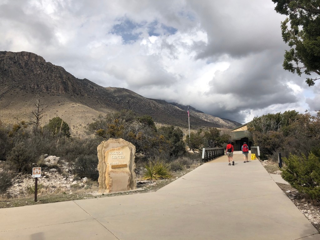
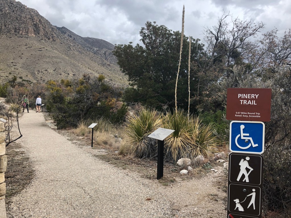
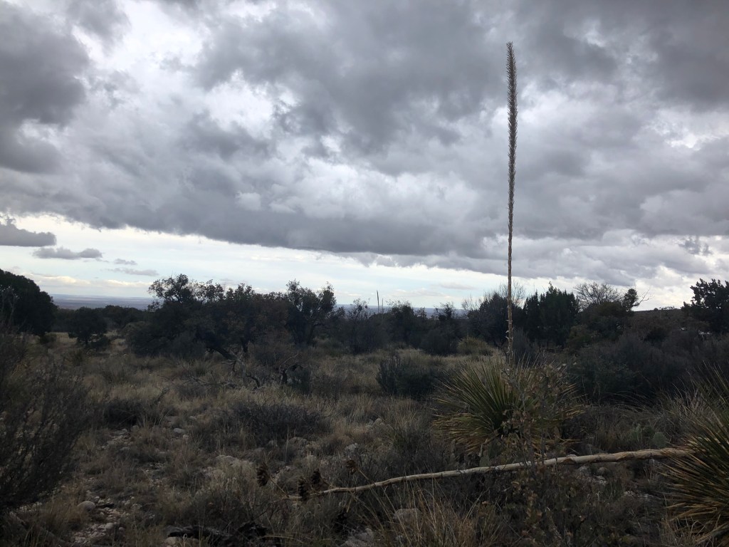
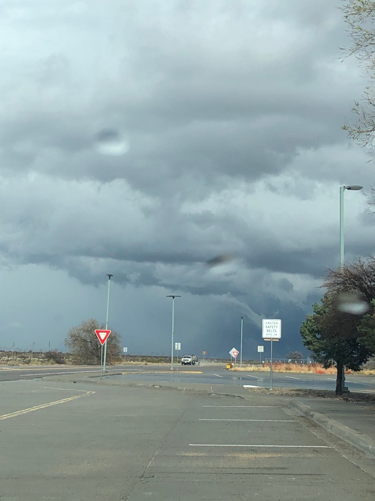
There’s a small trail right by the Visitor’s Center called the Pinery Trail that’s a little under a mile. It’s paved and goes to the ruins of the Butterfield Mail Route. I began the trail but this huge storm began to roll in. Ominous clouds and thunder with sharp lightning strikes darkened the sky very quickly, so I didn’t finish the trail and turned back.
The Visitor’s Center was about to close, and they don’t allow overnight parking there. But on the way here, I saw a Texas Department of Transportation Safety Rest Center, called Pine Springs Rest Stop. It’s only 6 miles from the center, so I head over there to wait out the storm.
And did it pour! For a good amount of time. I decided to to nap in the car, because sleeping in a car with a sunroof listening to the rain is just as fun.
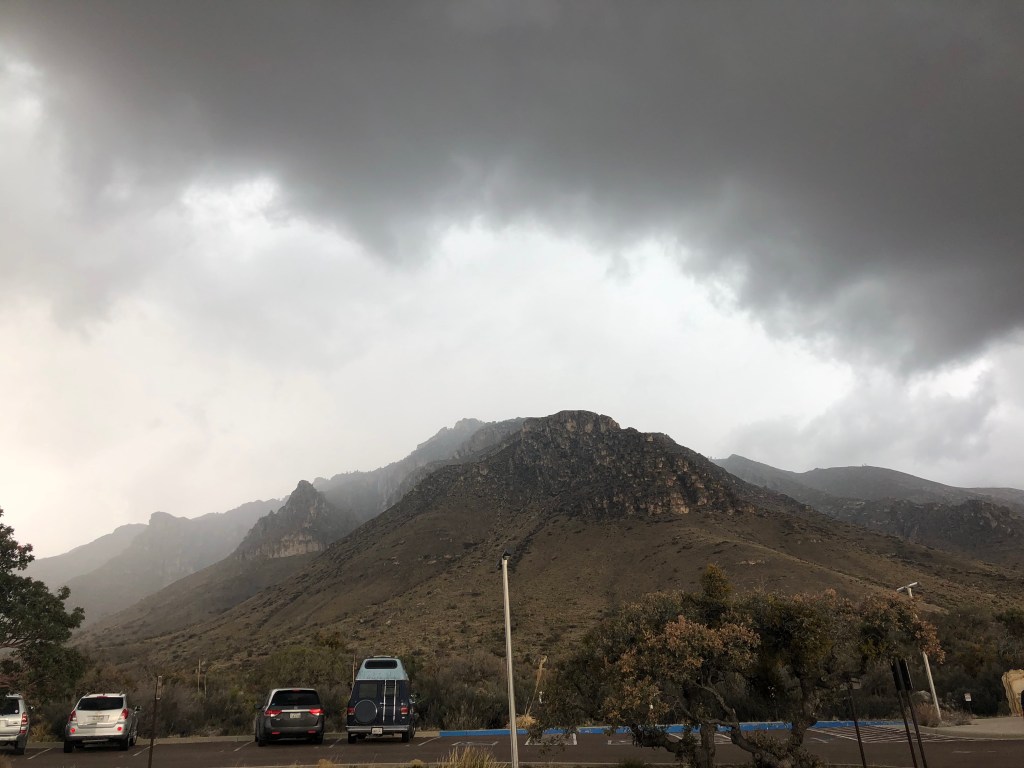
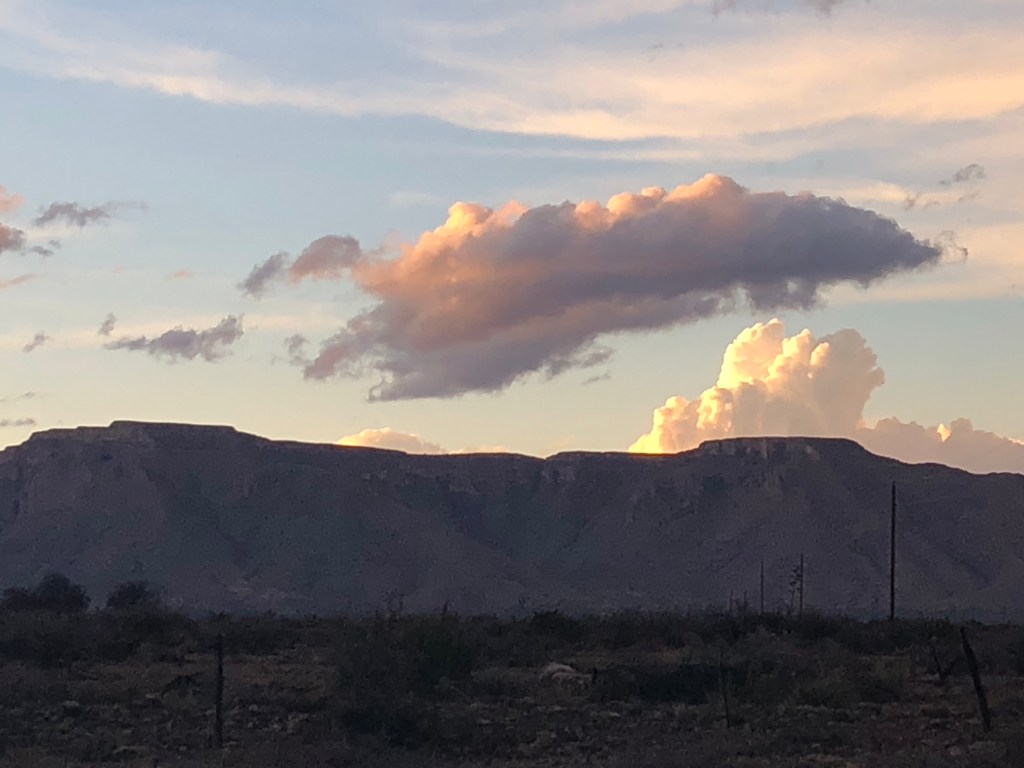
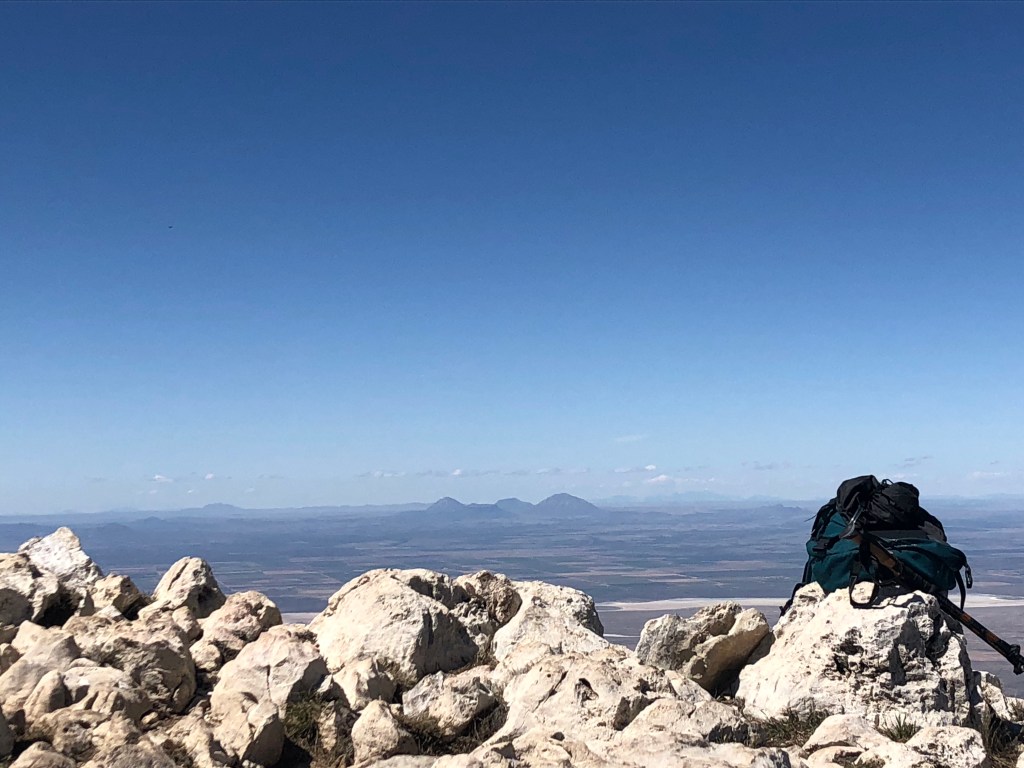
After the storm passes, I get some great views of the sky and mountains:
Even though the rest stop says there’s wireless internet, I get absolutely no signal. Only 25 minutes away is the New Mexico border, and the town of Whites City. (Carlsbad Caverns NP is actually only a few minutes away from here, so you could do 2 parks in one trip)!
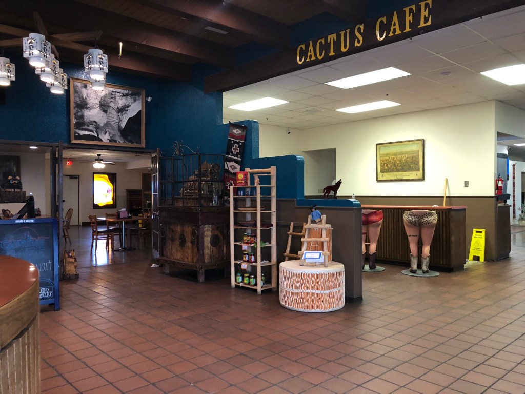
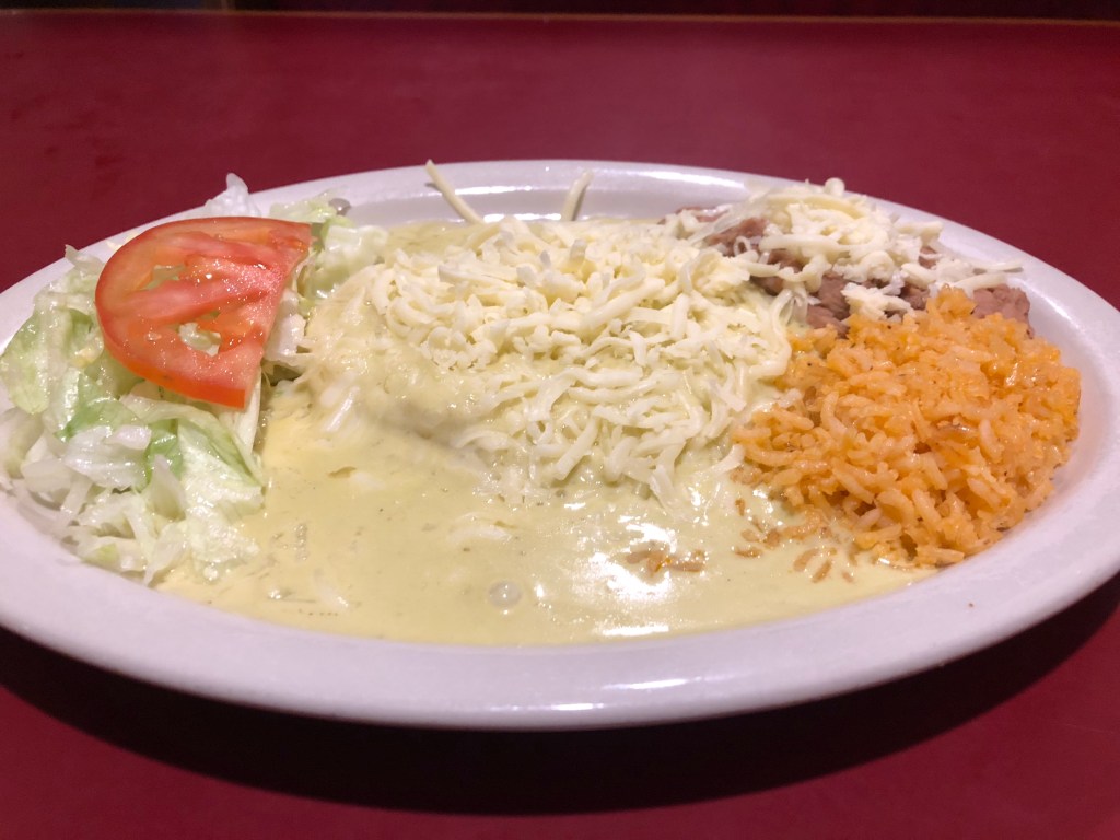
The town consists of a gas station, small strip mall type building, and one restaurant, the Cactus Cafe. I grub up on a green Chile enchilada plate.
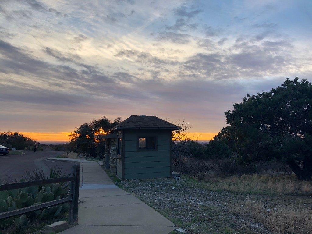
I figure the campground is probably very muddy, so I decide to sleep at the rest stop for the night. It’s lighted, I’ve seen State Troopers stop by, and there’s restrooms so I’m good with that. I even get to see a beautiful sunset.
The temperature drops for the night so I convert my backseat so I can lay down to sleep. I listen to some downloaded podcasts and I’m warm in the sleeping bag and I fall asleep.
03/14/2020
More rain came in overnight, but it was light but the wind was pretty strong. I woke up around 0540 and was happy to feel that I was safe all night here. I thought the street light was what woke me up but it was the bright, shiny moon coming through the window.
I change in the rest stop and head back to the park. The rangers had advised me yesterday to park in the RV lot early because it gets full, and I wasn’t the only one there that was super early! I’m also glad I brought a warm beanie and gloves for the morning.
0747 hrs.
I stay in the car because it’s windy and I’m charging my phone since the podcasts kind of drained it last night. I took some good sunrise pics, and almost got a ticket for forgetting to put my annual pass on my mirror. I listen to others getting out of their cars and prepping their gear and one guy warns another guy who’s only in a short sleeve shirt that it’s 20 degrees colder at the top.
0830 hrs.
I go to the trailhead which is the meeting point. I also get a pic of this cool vehicle:
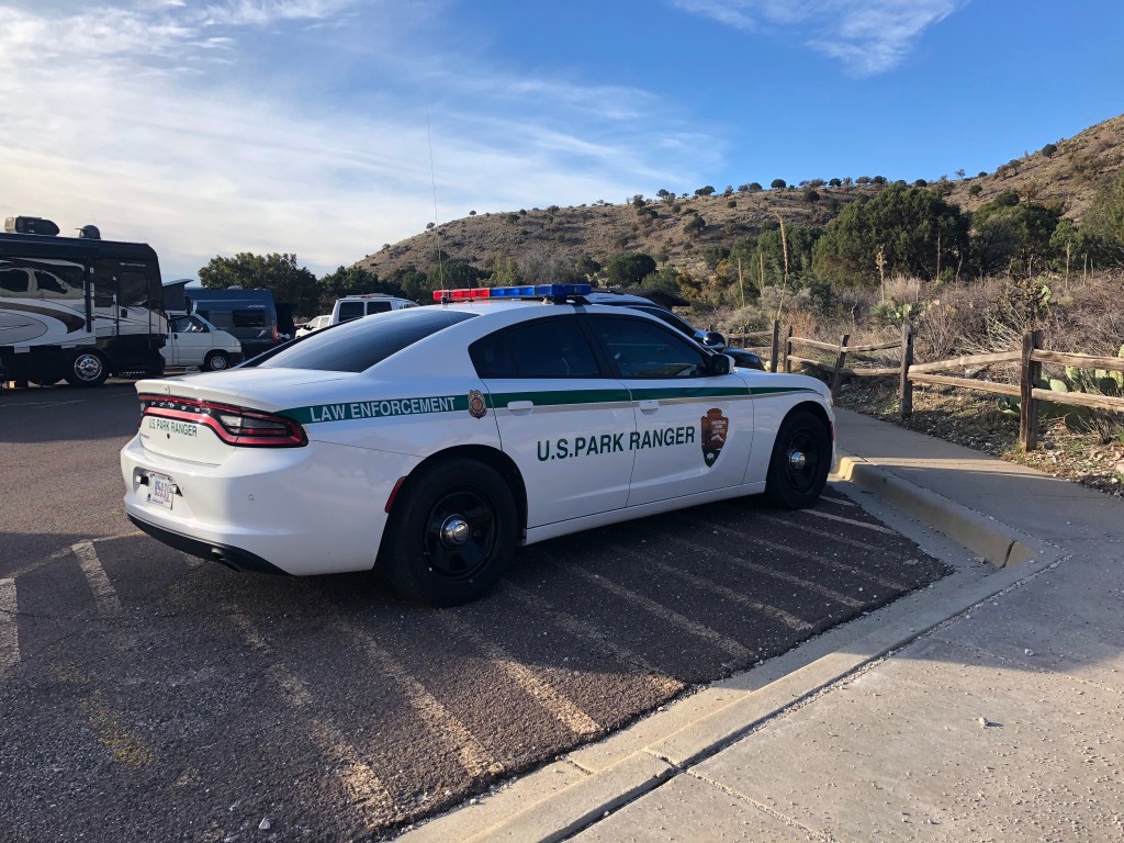
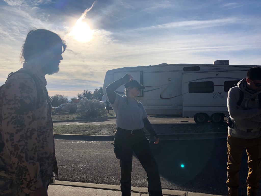
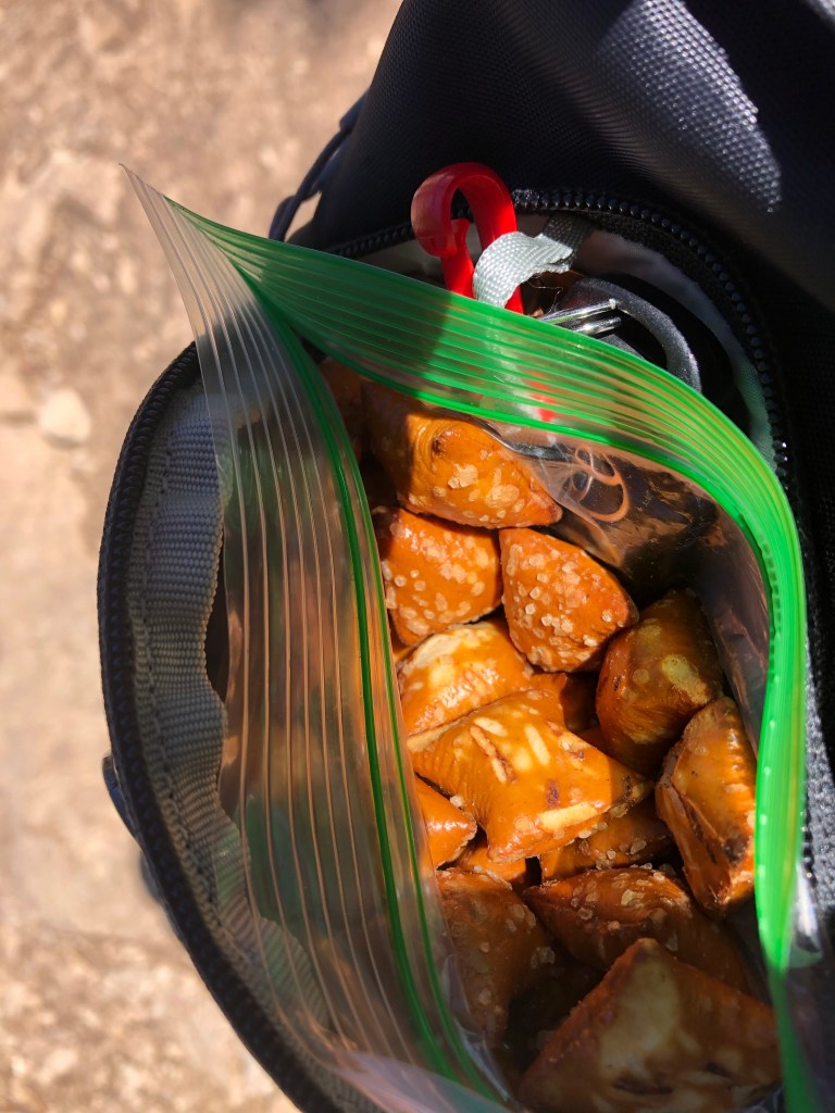
The Ranger, Amanda, makes sure we all have snacks and water before we start the hike. There’s about 10 of us altogether. A guy and his young son, a couple who are on vacation traveling through different parks, a lady who didn’t talk much, a guy in camp gear who lives on a farm, and an older man with his teenage son. We then set off!
Doing a Ranger-guided hike is great because you get to stop and learn about things along the way. Amanda tells us that this entire area used to be reefs underwater and that there are fossils here that geologists from all over the world come to study. She also says that a long time ago, there was talk of putting a tram system in the park to get to the top but that was scratched since this area is protected wilderness.
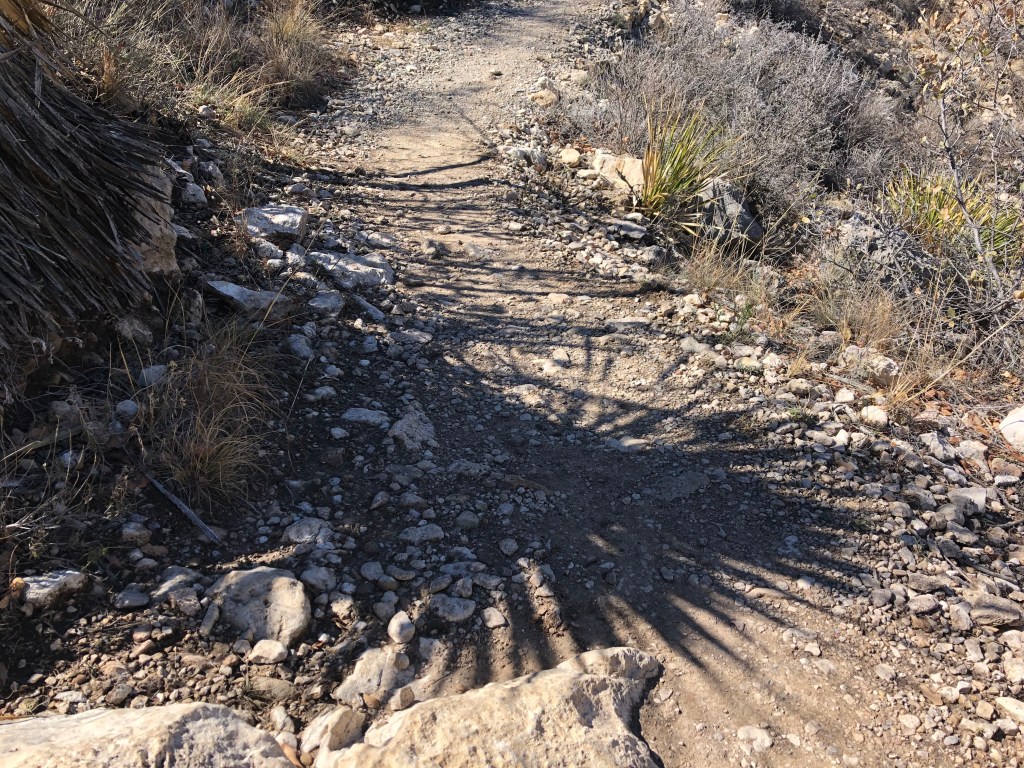
It’s fun to see the parking lot get smaller and the cars start to look like toys as we climb higher. This hike is no joke; the first part is rough switchbacks that climb in elevation pretty quickly, so we take it kind of slowly.
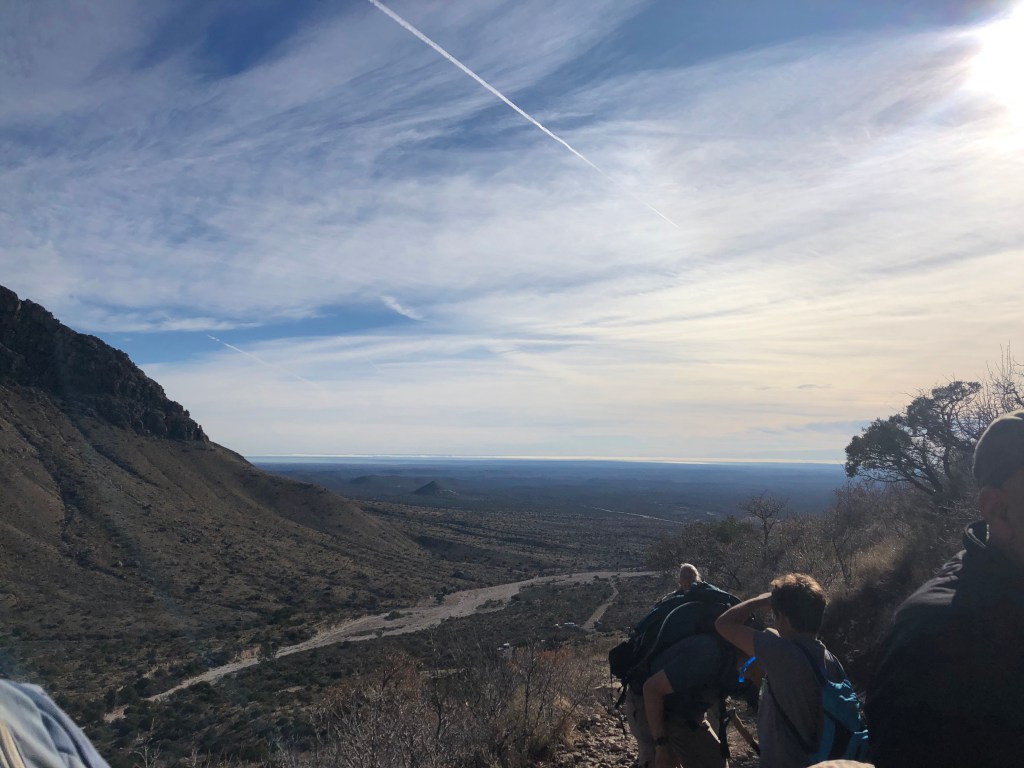
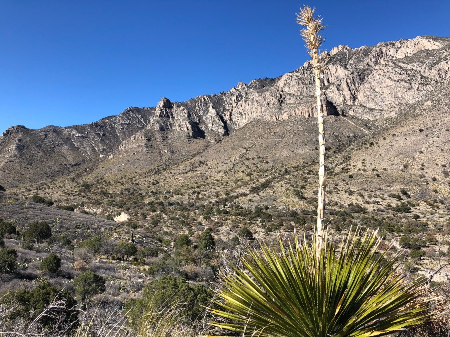
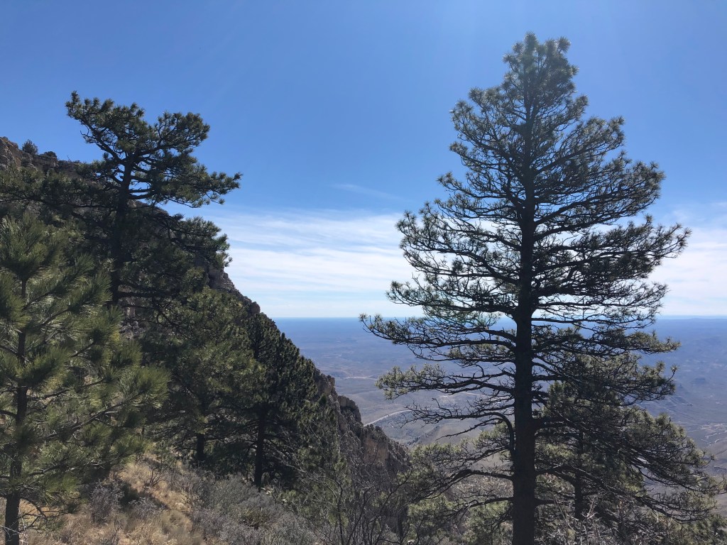
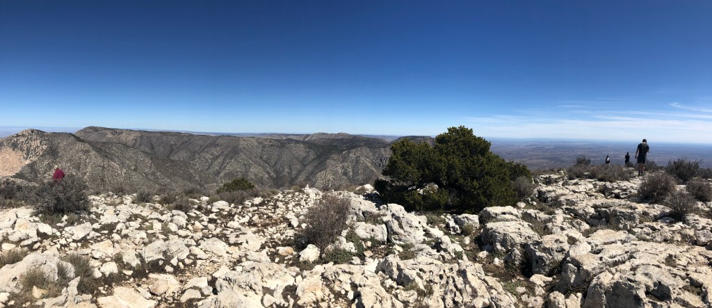
There were lots of stops to rest and enjoy the wonderful views!
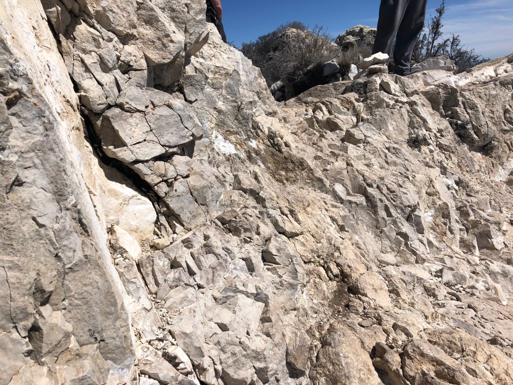
The rock formations were amazing, with the sun making the trail twinkle.
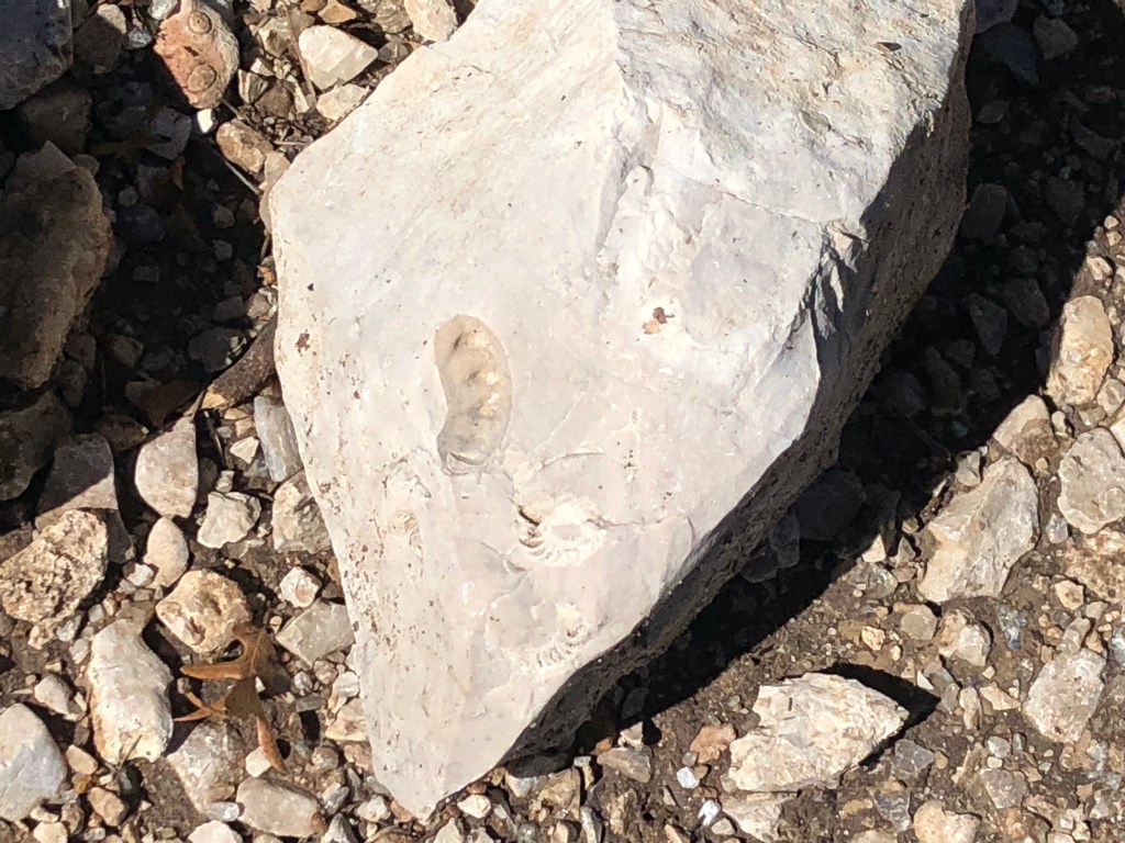
We even saw some shell-shaped fossils!
There’s a campsite near the base, where we stopped to snack. The campers there reported that the thunderstorm last night made it pretty scary.
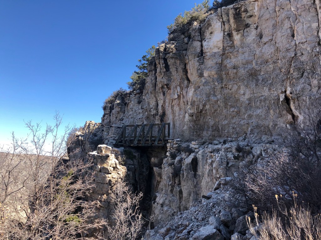
There’s a part where you come to cross this wonderful wooden bridge:
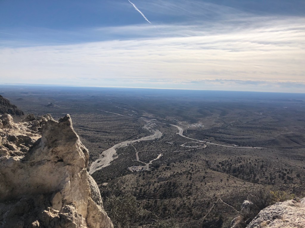
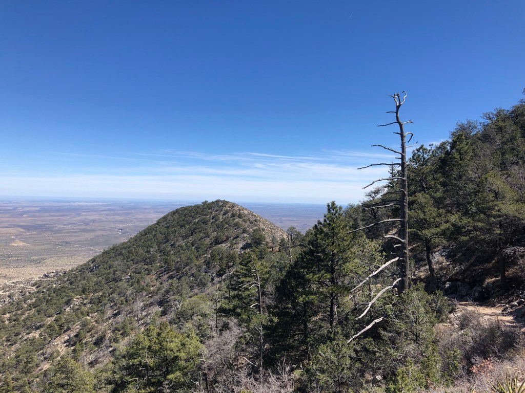
And get more spectacular views:
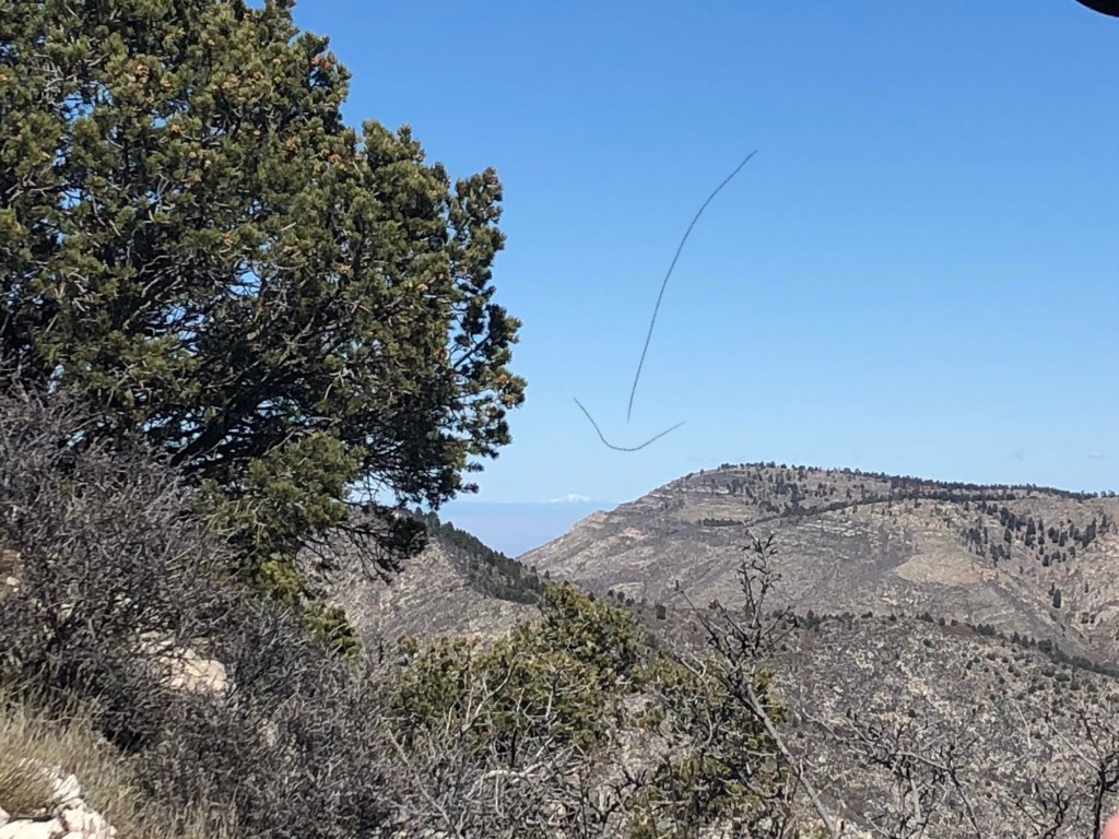
There’s a stop we make where Amanda points out a snow-capped mountain in the distance and tells us its Ruidoso, New Mexico!
1023 hrs.
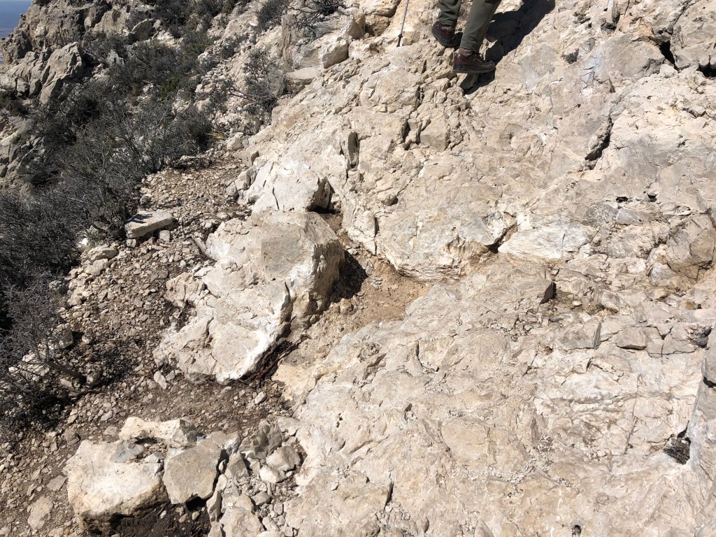
So close to the top now, and this part was the scariest because you literally have to hug the rock to continue: don’t look down!
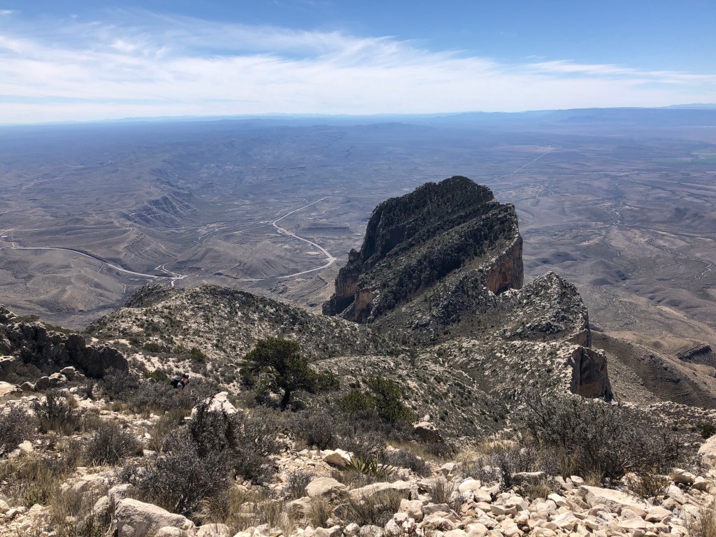
And you get to see the back side of the famous El Capitan:
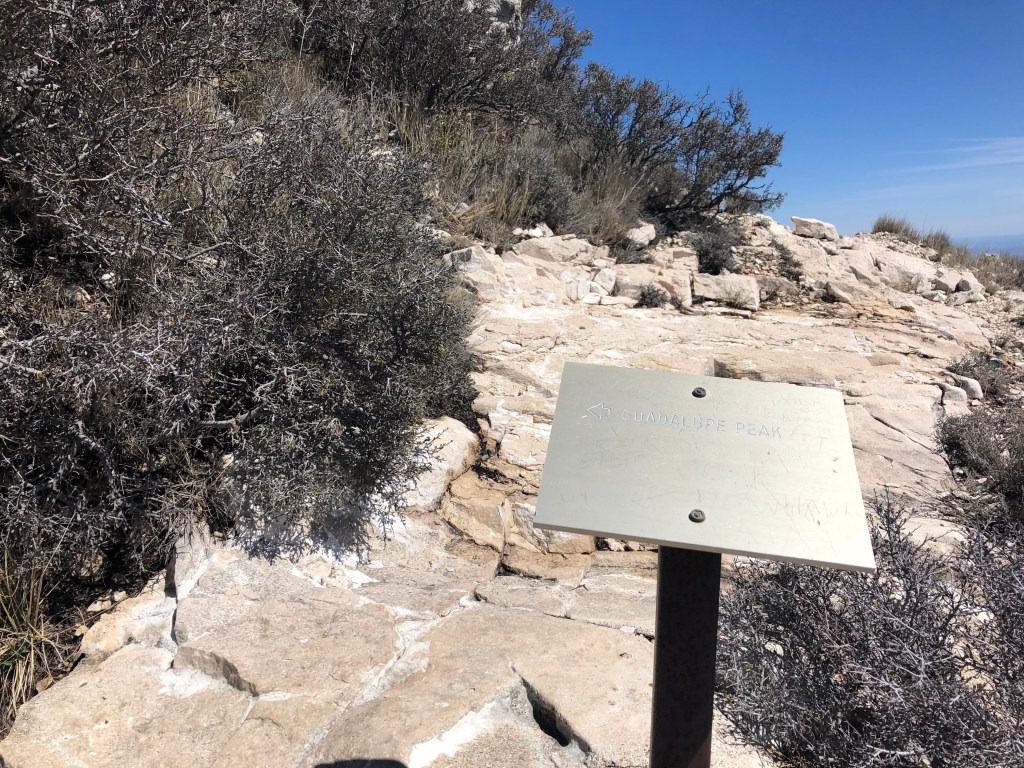
There’s a sign pointing you towards the peak:
We did hear an annoying buzzing sound, and it was coming from a drone, which Amanda said are illegal because they’re flying in Federal Space. Whoa. But she had a radio and reported it. The drone made the serenity of the top a literal “buzzkill”, but they stopped and landed it.
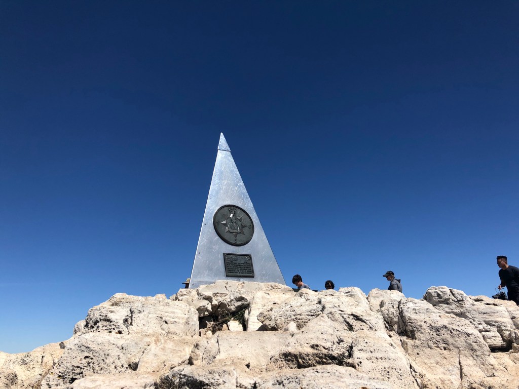
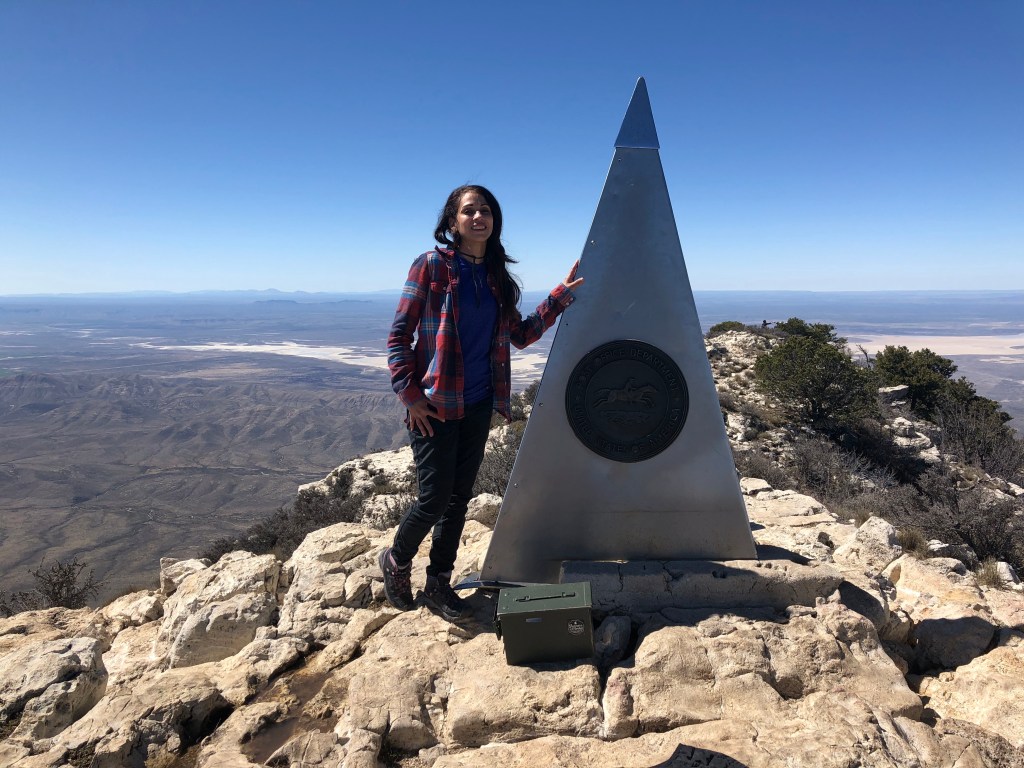
And then you’re there! I cough out a “yay, we made it!” And the others in the group say the same! The views are spectacular!
There’s this pyramid at the top that’s 3 sided: One side is dedicated to airmen who flew with American Airlines, one side is the American Airlines logo, and the other part has the US Post Office Department pic of a man on a horse.
There’s a little green box that contains a book where you can sign your name. Amanda says the logs are kept forever, and you could come back anytime and request to look at the book and show anyone where you signed your name.
Of course I signed it! (I added Yay next to my name).
All of us in the group take each other’s pictures for one another and chat with others at the top. Amanda says it’s the nicest weather she’s seen in forever at the top.
The return was at your own time and pace. After more snacking and water, I started the descent.
I thought the switchbacks going up was bad, they were nothing compared to going down. It’s hell on your knees and I’m glad for the trekking pole I had. I had to rest more times going down than coming up.
1350 hrs.
I see a family going up the trail with a small kid and a woman carrying a smaller kid who’s asleep. No thank you.
My legs are like jelly now. The one time I do take a slight slip is in front of people, of course.
1458 hrs.
I wonder how much it would hurt to roll down the mountain the rest of the way. I seriously contemplate this.
I also realize that these boots suck. My pinky toe is killing me, and I think I’d rather walk down in my socks. I actually contemplate this too.
I finally make it to the bottom again and I’m sooooo relieved that I didn’t have to use the restroom in the wild! Ha ha!!
I decided to go home instead of heading out to the McDonald Observatory since it was closed to the public. Driving back, I heard just how crazy the situation was becoming with this virus, and I knew I’d be needed back at work, because as a first responder, crime doesn’t stop for COVID-19, haha.
I later found out that this week, the National Park Service suspended all its ranger guides and activities, and closed its visitor centers for the time being for the “social distancing.” So I’m very glad to have had the opportunity to be on the guided hike, and hopefully will find some more places to go once everything calms down again.
